
Solar Farm Solutions
Your Land Could Be Part of the Energy Transition.
01Where to Start
Start With the Land, Not the Proposal.
Most conversations about solar on land start at the wrong end — with a capacity figure, an income estimate or a proposal deck. The useful conversation starts with the parcel itself: where it is, what shape it is in, how you reach it, and how far it sits from somewhere the power can go.
Those facts decide whether a project is worth pursuing. They also decide what anyone can sensibly offer you for the land. Until they are established, any number is speculation.
We work through them with landowners and developers, and where a site does go ahead we carry out the perimeter and boundary works that every built plant needs.
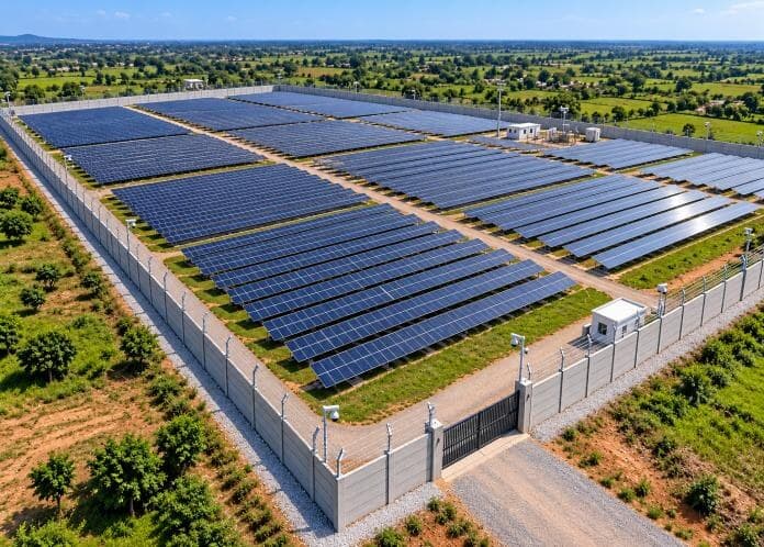
02Land Suitability
What Makes a Parcel Workable.
None of these alone decides a site. Together they tell you whether it is worth spending money on a proper assessment.
- Contiguous, usable area
- A single workable block is generally easier to develop than the same area split across scattered pieces. Shape and usable proportion matter as much as the headline figure.
- Terrain and slope
- Gentle, even ground reduces earthworks. Steep gradients, deep gullies and rocky outcrops add cost and can rule out parts of a parcel.
- Shading and obstructions
- Tall tree lines, structures and high-tension lines crossing the parcel affect how much of it can actually be used.
- Water, drainage and flooding
- Low-lying parcels, watercourses, tanks and seasonal flooding all affect layout and foundations.
- Surrounding land use
- Neighbouring activity, approach routes and future development around the site can matter as much as the site itself.
- Distance to a connection point
- Proximity to a substation or suitable line is often the single biggest factor in whether a parcel is worth pursuing.
03Project Requirements
The Physical Questions a Project Has to Answer.
Approximate area
Driven by design, not a fixed ratio
Land requirement follows from project capacity, module technology and efficiency, the mounting system, the row spacing chosen for the latitude and terrain, internal roads, drainage, plant areas and setbacks.
Two parcels of identical extent can support quite different capacities. We would rather assess your parcel than quote you a ratio.
Access and terrain
Can equipment actually reach it?
Approach roads have to carry construction traffic, including long and heavy loads. Width, surface, turning radii, bridges and culverts along the route all matter.
On site, internal roads, levelling and drainage follow the terrain. A right of way that exists in practice but not on paper is a problem worth finding early.
Grid connectivity
Where does the power go?
Distance to a suitable substation or line, available capacity at that point, the voltage level, the route the evacuation line would take, and the approvals required for it.
Connection capacity is finite and is allocated through the relevant authorities and the distribution licensee. It is not something a consultant can promise.
04Agricultural Land
Farmland Has Its Own Rules.
Agricultural holdings raise questions that do not arise on other land: how the parcel is classified, what use is permitted, whether a change of use is required, and which scheme route — if any — applies.
These rules are set by the state, differ between states, and change over time. The answer for a holding in one district is not necessarily the answer for yours.
Where an agricultural project is in scope, PM-KUSUM may be relevant depending on the component and the eligibility rules in force. It is administered through state nodal agencies, and is separate from the residential rooftop scheme.
05Ownership & Documentation
Papers Decide More Deals Than Land Does.
A parcel that is physically perfect but unclear on paper will stall. Developers and lenders look at this first — so it is worth looking at it first yourself.
- Title and ownership
- Clear title, the chain of ownership, and whether the holding is individual, joint or in a family arrangement.
- Revenue records
- Current survey records and mutation entries consistent with the claimed ownership and extent.
- Encumbrances
- Existing loans, charges, leases, tenancies or disputes affecting the parcel.
- Land classification and permitted use
- How the land is classified, what the current permitted use is, and what change of use — if any — a project would require. This is state-specific and must be confirmed locally.
- Access rights
- Whether the approach to the parcel is a recorded right of way or depends on a neighbour's goodwill.
06Site Infrastructure
What a Built Site Actually Needs.
Beyond the array itself, a plant needs internal roads, drainage, foundations, plant and inverter areas, and a secure perimeter.
Perimeter work is our own core business. We supply and install precast RCC compound boundary walls and solar plant fencing, including provision for barbed or razor wire where specified, along with the foundation and civil works that go with them.
Wall heights, panel dimensions, post spacing, reinforcement and concrete specification are configured to the project. Final dimensions and pricing are confirmed after site inspection.
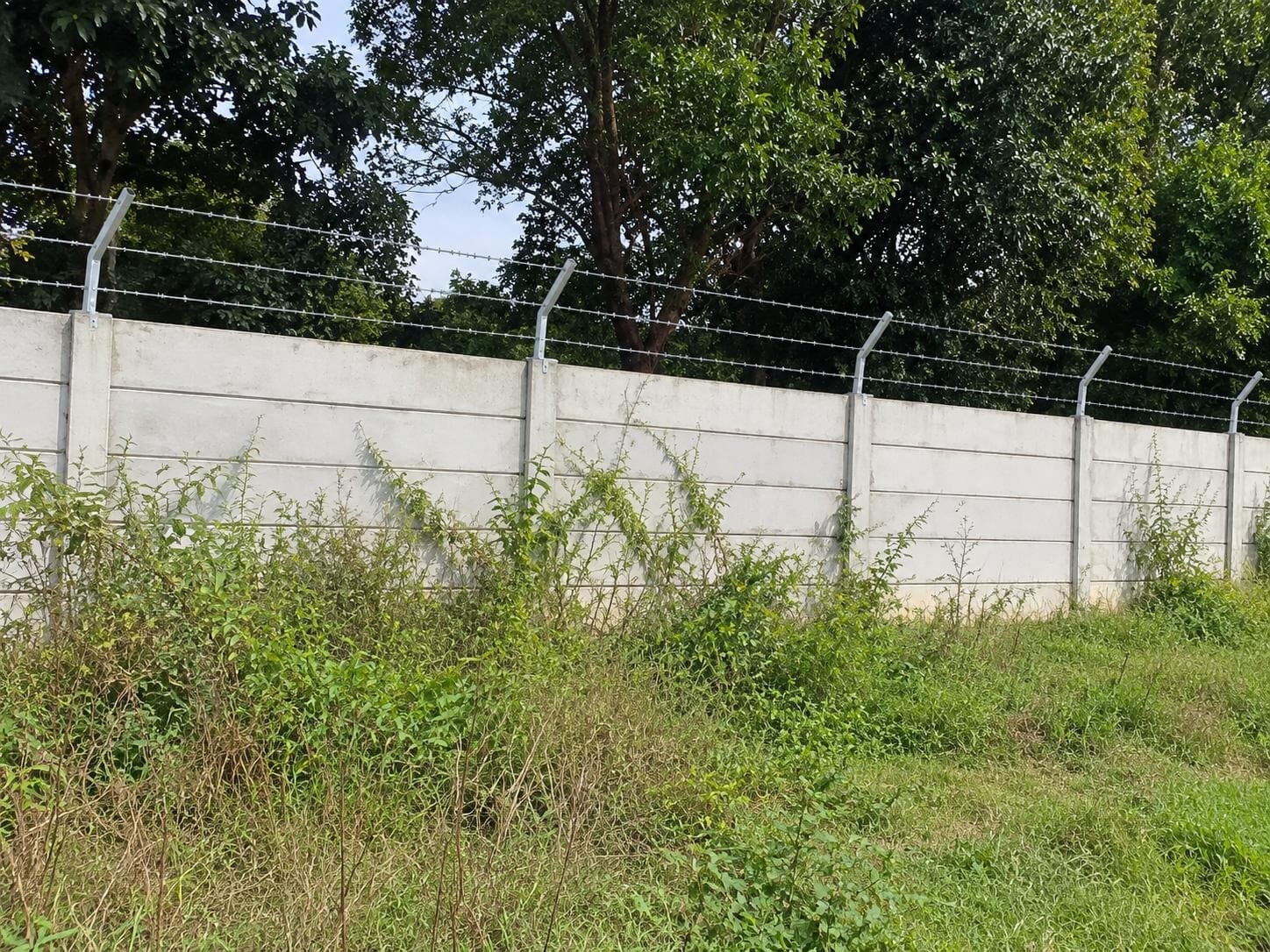
Precast RCC boundary wall with barbed wire — site photograph.
07Project Development
How a Site Moves From Question to Project.
01
Initial conversation
What you hold, where it is, and what you are hoping to achieve with it.
02
Desk review
A first look at location, approximate extent, access and distance to a likely connection point.
03
Site visit
Walking the parcel: terrain, obstructions, approach, drainage and boundary condition.
04
Documentation review
Title, revenue records, classification and encumbrances, reviewed with your own legal advisers.
05
Technical assessment
Indicative layout and the engineering questions a developer or lender will ask.
06
Structuring and introductions
Deciding which structure suits you, and bringing the right counterparties to the table.
08Structures
Four Ways a Landowner Can Take Part.
Each carries a different balance of control, risk and timing. The right one depends on your circumstances, not on which is most common.
- Lease to a developer
- You retain ownership and the land is leased for the project term. Rent, escalation, term and exit conditions are all negotiated — none of them are fixed or guaranteed in advance.
- Outright sale
- The parcel is sold to a developer or investor. Simplest to complete, and ends your interest in the site.
- Joint development
- The landowner contributes land into a structure alongside a development partner, sharing both risk and outcome.
- Owner-developed project
- You develop the project yourself, with external support for design, procurement and construction. The highest commitment and the highest exposure.
09Questions
Straight Answers.
How much land does a solar project need?
There is no single figure. Land requirement depends on project capacity, module technology and efficiency, mounting system, row spacing chosen for the latitude and terrain, internal roads, drainage, plant areas and setbacks. A sloping or irregular parcel uses more land than a flat rectangular one for the same capacity. Any number quoted before a site is assessed is a rule of thumb, not a project figure.
What will I earn from leasing my land?
We do not quote lease rates or income figures, and we would be cautious about anyone who does before seeing your land. What a developer will pay depends on location, connection distance, parcel quality, the project's own economics and the terms negotiated. We can help you understand what drives the number and review what is offered — we cannot promise an amount.
Can agricultural land be used for a solar project?
It depends on the state, the land's classification and the project route. Some routes allow renewable energy use on agricultural holdings, and some require a change of land use before a project can proceed. The position is state-specific and changes over time, so it must be confirmed for your particular holding with the competent local authority and your own legal advisers.
How important is distance to the grid?
Very. The cost of the evacuation line and the availability of capacity at the connection point can make or break a project. A parcel that is otherwise ideal but far from a viable connection point may not be developable at a sensible cost. This is usually one of the first things we look at.
Do you buy land?
Our role is consultation, coordination and the perimeter and civil works that built sites need. Where a sale is the right route for a landowner, we work with developers and partners rather than acquiring the land ourselves.
Will you guarantee that my project gets approved?
No. Approvals are decided by the relevant authorities against their own criteria and current rules. Nobody outside those authorities can guarantee an outcome, and we will not suggest otherwise.
10Land Enquiry
Tell Us About Your Land.
11Next Step
Not Sure Whether Your Parcel Qualifies?
Send us the location and approximate extent and we will tell you honestly whether it is worth taking further.